Tag Archive for ‘adventure’

Washed Up

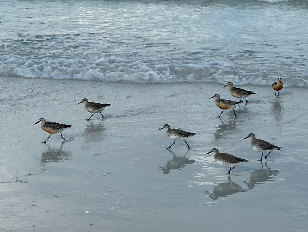
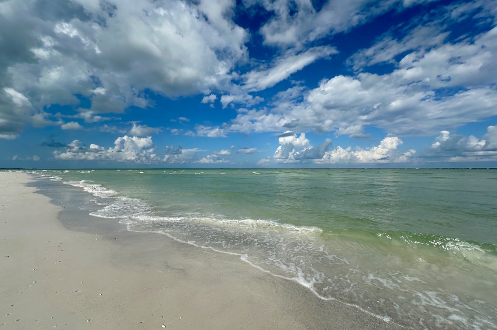
Last week I took advantage of a slightly overcast morning to wander the beach at nearby Fort De Soto Park. I hit the sand shortly after the park opened, so it was just me and the literal early birds out there.

My avian friends mainly consisted of Willets (Tringa semipalmata) and Red Knots (Calidris canutus rufa). The former hang out here year-round while the latter are just stopping over on their migration from the circumpolar region to the southern tip of South America. That’s an epic 9,000 mile journey for a bird that’s only slightly larger than a robin with just a 22″ wingspan!

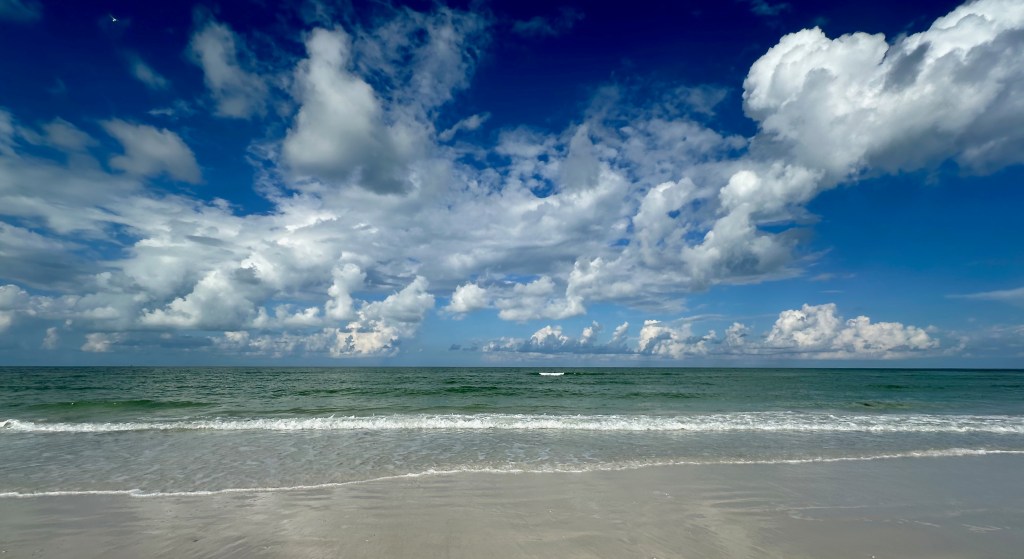
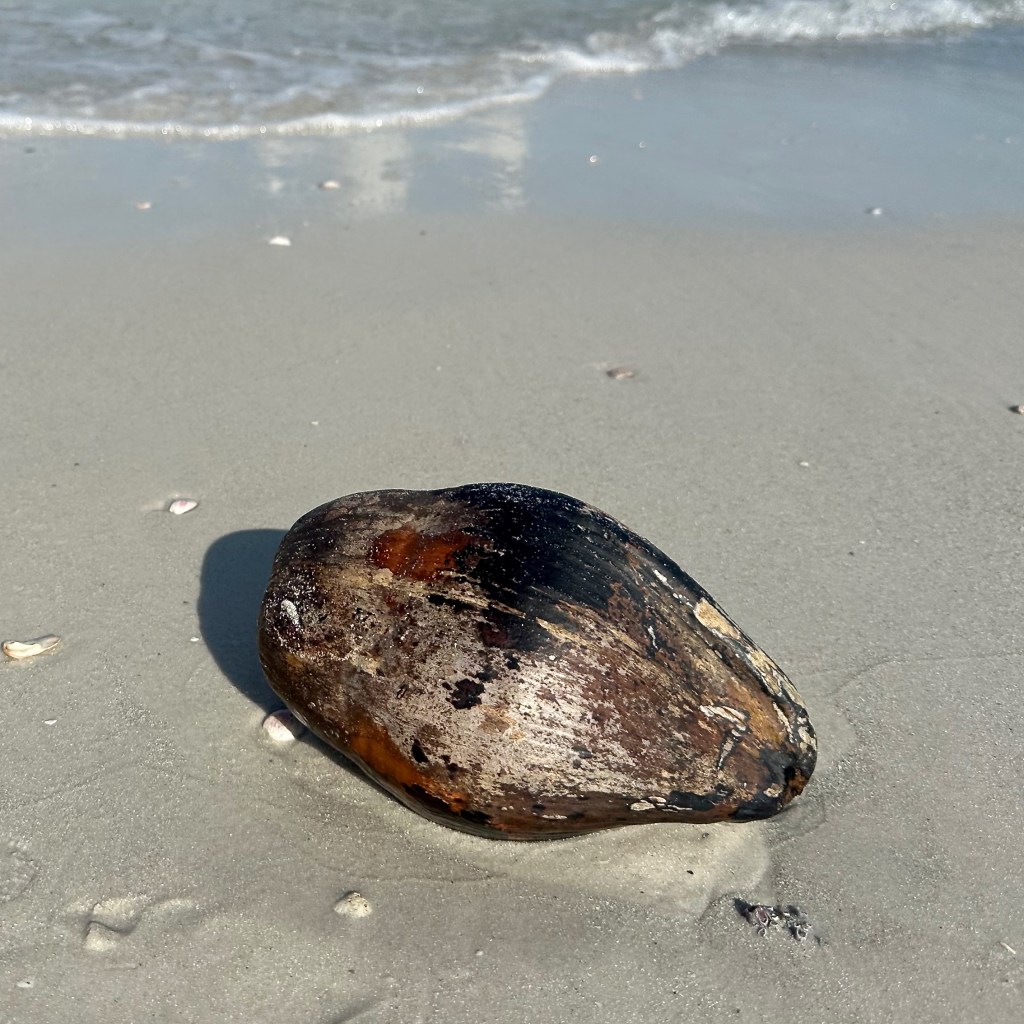
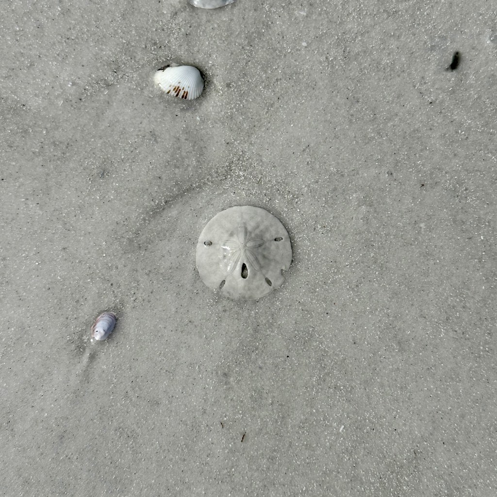
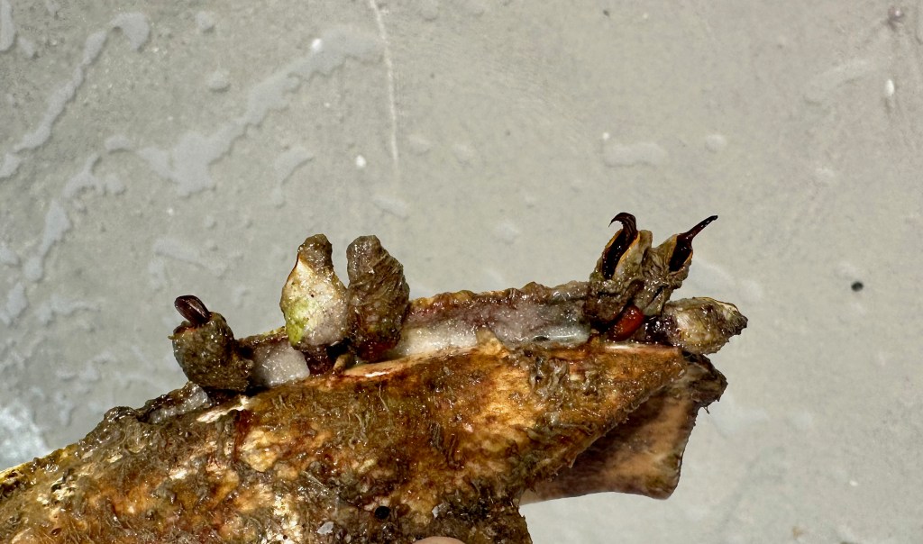
The scattered clouds put on quite a show up in the sky while the gulf left random treasures on the beach for me. In order of appearance: non-edible Sea Liver (Eudistoma hepaticum), edible Sea Lettuce (Ulva lactuca), coconut, sand dollar, piece of broken plastic hosting Stalked Sea Squirts (Styela clava) invasive stowaways, and a Tootsie Roll-shaped chunk of manatee scat (definitely not edible).

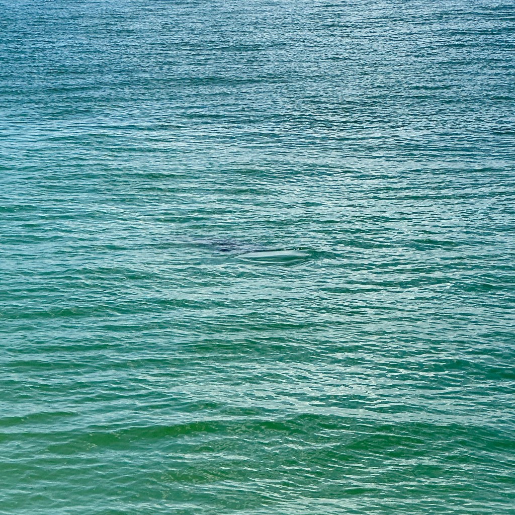
The scat looked fairly fresh so I scanned the water and was fortunate to spot a chubby mermaid just offshore. Unless they are part of a mating mob, manatees typically aren’t that active, preferring to just bob along feeding and farting (that’s how they control their buoyancy).

After they surface for a breather the natural oils on their skin leave behind just enough of residue to change the surface tension of the water which creates a tell-tale circular “footprint”. I may not get a good visual of the manatee but I know where it is. No matter what its always a treat to see them.

What a great way to start the day!

Dismal, Indeed!

When mapping out my route from Raleigh to Chesapeake, Virginia I noticed the Great Dismal Swamp on the map. I didn’t know much about it but with a name like that who could resist checking it out? 

Midafternoon I pulled into the Dismal Swamp State Park in northern North Carolina. A relatively small park, it provides access to a narrow swath of land alongside the historic Dismal Swamp Canal. My first stop was the visitor center where I was pleasantly surprised by both the history and nature exhibits.  

Less than half of the original million acres of swampland remain, much of it drained for settlement and logging. The majority of the bald cypress trees that once towered over the murky water were cut down for building materials for the early colonists. As you might imagine, transporting the logs out of that morass was incredibly difficult.

During a visit in 1763, a 31-year-old gentleman farmer by the name of George Washington proposed building a canal in the landlocked area. Twenty years later work commenced. When it finally opened in 1805, the 22-mile long watery highway was a boon to commerce between North Carolina and Virginia.

Taking a hint from the name, I used up the last of my can of bug repellant before hitting the trails. Unfortunately, I was the only person on the boardwalk which meant I was the best food source around. The constant whine of mosquitoes I expected, but the fierce chomps of biting flies caught me off guard. Either I’m delicious or they were starving because they were relentless.

My curiosity wouldn’t be thwarted so I continued on to the path along the canal. In between swatting insects I pondered the struggle of the slaves who dug out the waterway over 12 long years. A testament to their hard work, it remains the oldest operating canal in the country, though these days it mostly just carries recreational boat traffic.

A fast-moving thunderstorm abruptly ended my explorations. A bit of a mixed blessing, I ended up soaking wet but at least the rain chased the insects away. The term dismal was given by early settlers to any swampy area, but its easy to see how this place earned the moniker Great Dismal Swamp. Dismal, indeed!

I ended my day with a brief trip to Virginia Beach, which I didn’t have much time to enjoy it as another big storm chased me off the sand. Some days are just like that…

Virginia Beach with Incoming Storm

Adventuring Home

I decided to do a bit more exploring before leaving the Panhandle last weekend. I was lured to Ochlockonee River State Park by the possibility of sighting an endangered Red-cockaded Woodpecker, or their piebald squirrels, or even river otters.

No luck with any of those but I still had a great time in this section of the Apalachicola National Forest. The park’s main waterway (and namesake) is a unique blackwater river, the water isn’t murky but it is a dark, burnt orange from all the tannins. No surprise that Ochlockonee in native Hitchiti means yellow river.

The park protects a small remnant of a Longleaf Pine (Pinus palustris) forest. Pre-European settlement there was an estimated 90,000,000 acres of these trees in the South. Longleaf Pines were prized by early settlers not only for their wood but for their resin. Collected by hatching the bark, resin was processed into turpentine used to waterproof boats, an important part of the naval stores industry.

Much of the state park land was purchased from the Phillips Turpentine Company in the early 1930s, as demand for turpentine waned. Sadly, because of deforestation and overharvesting only about 3% of the original Longleaf Pine forest remains in the US.

A short drive later I entered St. Marks National Wildlife Refuge. For me, the main draw of the refuge’s 83,000 acres was the St. Marks Lighthouse, the second-oldest one in the state. First lit in 1831, the tower weathered many hurricanes and even withstood a Confederate attack in 1865 before finally being deactivated in 2016.

The refuge is best accessed from the water but I enjoyed wandering the few trails, pleasantly surprised by the Spring flowers I encountered. All the leg-stretching came in handy on my long drive home that evening.

It was a quick visit but I’m glad I made the trip up to the Panhandle, it’s been on my list of places to see for a few years now. There’s always so much to see and discover!